Mountaineering

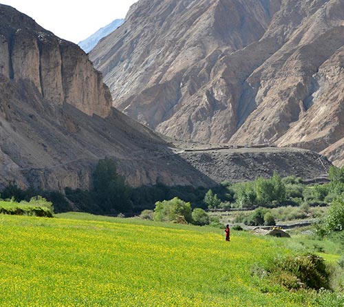
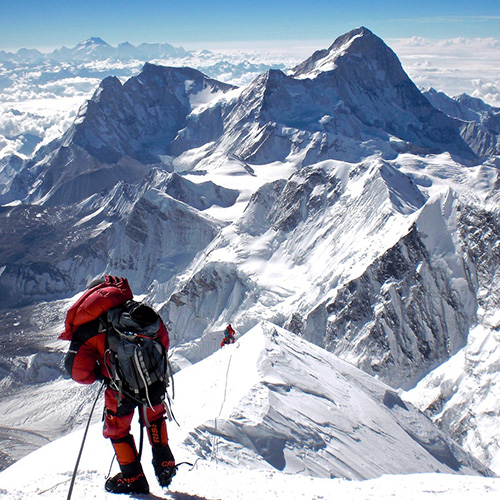
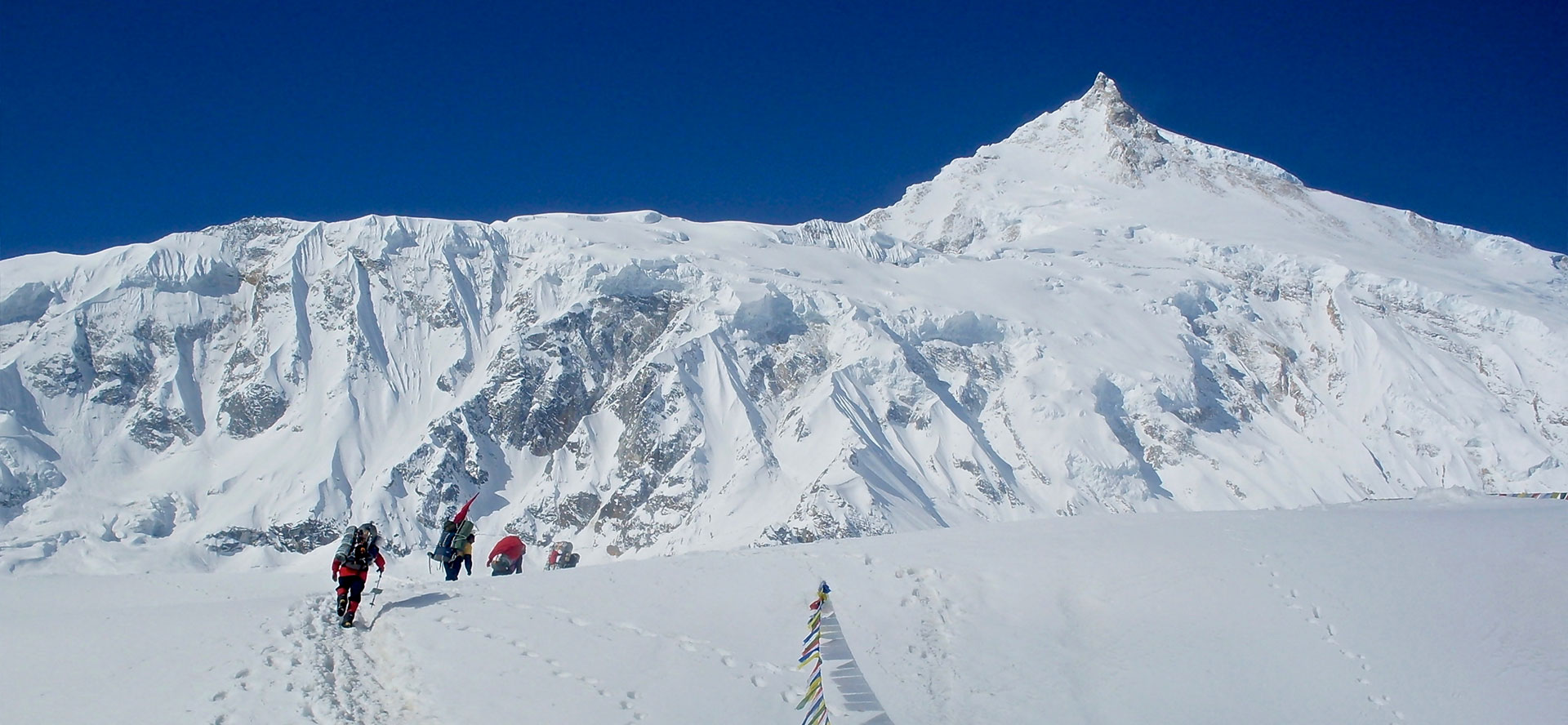
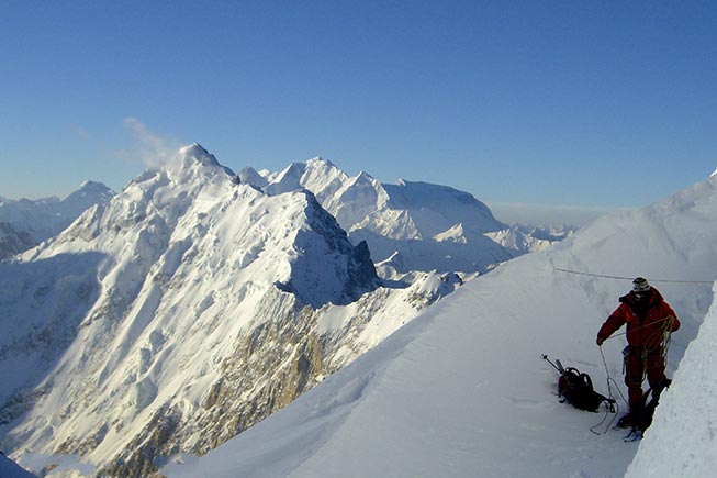
Besides trekking and other adventure activities, Rimo Expeditions caters to all kinds of mountaineering expeditions, be it for beginners who would like a guided climb to a trekking peak or a 7,000-m+ expedition in the Indian and Nepal Himalaya and East Karakorams.

Rimo Expeditions with its expertise and experience over the years has gained an unbeatable reputation in the field of adventure. Known for their thorough logistical support, excellent and dedicated field staff, international standards of service with a keen eagerness to continue improving and providing the best, we have organized expeditions for Sir Chris Bonnington to the Karakorams, French expedition to Rimo IV in the Karakorams, Japanese Alpine Club expedition to the Eastern Karakorams where it was the first time anyone had stepped foot on Teram Shehr Ice Plateau, other expeditions in the Garhwal Himalaya being among a few. The Expeditions to the eastern Karakorams where exploratory tours treading unknown territory have all been successful due to our knowledge, expertise and dedicated staff who unfailing look to every minute detail that goes into the successful planning of an expedition.

Rimo Expeditions can also proudly claim to be the only company in India or perhaps in the Adventure trade in the Himalaya who are able to cater to a fully equipped mountaineering expedition providing the necessary hardware gear required, making it possible for expeditions to travel with only their personal gear and a few essential items thus saving them the hassles and expenses of freighting goods back and forth.

Rimo Expeditions is here for not only the novice climber seeking a guided climb but we are here for the experienced climbers who have always dreamt of climbing in the Indian Himalaya but have avoided doing so due to the logistical hassles.

Kamet

  • Elevation : 7756m (25447ft)
  • Location : Uttarakhand, India
  • Range : Garhwal Himalaya,India
  • Coordinates : 30" 55 ' 13" N, 79 "35' 37" E
  • Route : Joshimath to Ghamsali by road - 83kms. Trek via Niti, Basudhara and then base camp (Dobla Tal)
  • First Ascent : June 21,193, by Frank Smythe, Eric Shipton, R.L. Holdsworth and Lewa Sherpa

Kedardome

  • Elevation : 6830m, (22,402ft)
  • Location : Uttarakhand, India
  • Range : Garhwal Himalaya,India
  • Coordinates : 30˚ 48’ N, 79˚ 04’ E
  • Route : Road till Gangotri then trek via Chirbasa, Bhojbasa, Gaumukh, Tapoban and then base camp (Khara Pathar)

Kalanka

  • Elevation : 6931m, (22,734ft)
  • Location : Joshimath - Uttarakhand, India
  • Range : Garhwal Himalaya, India
  • Coordinates : 30° 30’ N, 79° 56’ E
  • Route : Road till Jumma then trek via Dunagiri, Bagni Kharak and then base camp

Hathi Parbbat

  • Elevation : 6727m, (22,065ft)
  • Location : Joshimath - Uttarakhandl, India
  • Range : Garhwal Himalaya, India
  • Coordinates : 30° 36’ N, 79° 36’ E
  • Route : Road till Gobindghat then trek via Bhyundar, Rajkharak and then base camp

Meru

  • Elevation : 6361m, (20,864ft)
  • Location : Gangotri - Uttarakhand, India
  • Range : Garhwal Himalaya, India
  • Coordinates : 29° 52’ N, 79° 02’ E
  • Route : Road till Gangotri then trek via Chirbasa, Bhojbasa, Gaumukh, Tapoban and then base camp (Khara Pathar)

Nanda Ghunti

  • Elevation : 6309m, (20,694ft)
  • Location : Joshimath - Uttarakhand, India
  • Range : Garhwal Himalaya, India
  • Coordinates : 30° 28’ N, 79° 43’ E
  • Route : Road till Setel then trek via Sutol, Lata Ki Khopri, Chandania Ghat and then base camp (Homkund)

Satopanth (Route -I)

  • Elevation : 7075m, (23,206ft)
  • Location : Joshimath - Uttarakhand, India
  • Range : Garhwal Himalaya, India
  • Coordinates : 30° 50’ N, 79° 13’ E
  • Route : Road till Mana later trek via Bhagirath and then base camp

Satopanth (Route -II)

  • Elevation : 7075m, (23,206ft)
  • Location : Gangotri - Uttarakhand, India
  • Range : Garhwal Himalaya, India
  • Coordinates : 30° 50’ N, 79° 13’ E
  • Route : Road till Gangotri later trek via Chirbasa, Bhojbasa, Gaumukh, Nandanban and then base camp

Chaukhamba II

  • Elevation : 7070m, (23,190ft)
  • Location : Gangotri Glacier - Uttarakhand, India
  • Range : Garhwal Himalaya, India
  • Coordinates : 30°30° 43’ N, 79° 15’ E
  • Route : Road till Gangotri later trek via Chirbasa, Bhojbasa, Gaumukh, Tapoban and then base camp at Khara Pathar

Bhagirathi I

  • Elevation : 6856m, (22,488ft)
  • Location : Gangotri - Uttarakhand, India
  • Range : Garhwal Himalaya, India
  • Coordinates : 30° 51’ N, 79° 09’ E
  • Route : Road till Gangotri later trek via Chirbasa, Bhojbasa, Gaumukh, Nandanban and then base camp

Shivling

  • Elevation : 6543m, (21,461ft)
  • Location : Gangotri Glacier - Uttarakhand, India
  • Range : Garhwal Himalaya, India
  • Coordinates : 30° 52’ N, 79° 04’ E
  • Route : Road till Gangotri later trek via Chirbasa, Bhojbasa, Gaumukh, and then base camp at Tapoban

Changabang

  • Elevation : 6866m, (22,520ft)
  • Location : Joshimath - Uttarakhand, India
  • Range : Garhwal Himalaya, India
  • Coordinates : 30° 29’ N, 79° 65’ E
  • Route : Road till Jumma later trek via Dunagiri village, Bagni Kharak (base camp)

Nun

  • Elevation : 7135m, (23,409ft)
  • Location : Suru Valley – Jammu & Kashmir, India
  • Range : Himalayn Range, India
  • Coordinates : 33° 58’ N, 76° 01’ E
  • Route : Its easy accessibility from the Kargil-Padum road and the shortest possible approach march to the base camps makes this massif the most attractive climbing destination in the Great Himalayan
  • First Ascent : 1953 by Pierre Vittoz (French), Claude Kogan (Swiss) from West Ridge

Kun

  • Elevation : 7077m, (23,218ft)
  • Location : Suru Valley – Jammu & Kashmir, India
  • Range : Himalayn Range, India
  • Coordinates : 33° 58’ N, 76° 01’ E
  • Route : Its easy accessibility from the Kargil-Padum road and the shortest possible approach march to the base camps makes this massif the most attractive climbing destination in the Great Himalayan
  • First Ascent : 1953 by Pierre Vittoz (French), Claude Kogan (Swiss) from West Ridge

Saser Kangri

  • Elevation : 7672m, (25,171ft)
  • Location : Saser Muztagh – Jammu & Kashmir, India
  • Range : East Karakoram, India
  • Coordinates : 33° 58’ N, 76° 01’ E
  • Route : Its easy accessibility from the Kargil-Padum road and the shortest possible approach march to the base camps makes this massif the most attractive climbing destination in the Great Himalayan
  • First Ascent : 1953 by Pierre Vittoz (French), Claude Kogan (Swiss) from West Ridge

Momostang Kangi

  • Elevation : 7077m, (23,218ft)
  • Location : Suru Valley – Jammu & Kashmir, India
  • Range : Himalayn Range, India
  • Coordinates : 33° 58’ N, 76° 01’ E
  • Route : Its easy accessibility from the Kargil-Padum road and the shortest possible approach march to the base camps makes this massif the most attractive climbing destination in the Great Himalayan
  • First Ascent : 1953 by Pierre Vittoz (French), Claude Kogan (Swiss) from West Ridge

Climb Kangyatse shoulder

  • Lamayuru monastery and unique landscape
  • Cultural Interaction
  • Rafting on the Indus
  • Panoramic views
$ 2284

  • Trip Duration
    19 Days
  • TRIP GRADE
    Moderate to strenuous
  • TRIP CODE
    RIKANG
  • Activity
     Mountaineering